0m
0m
1000m
Back to Catalog
PQWT-S150.150M
GT Series

PQWT-S150.150M

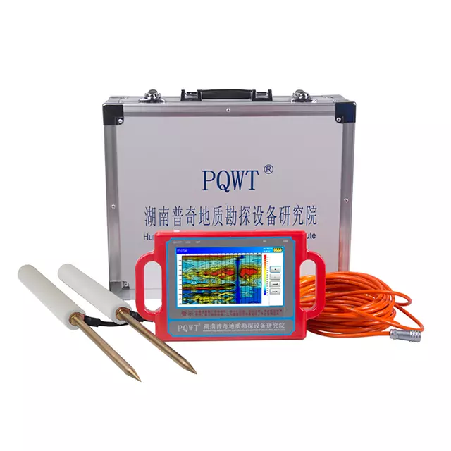
PQWT-S150.150M Automatic Mapping Water Detector can easily find groundwater resources by scientific methods, it is based on the field source of earth's electromagnetic field and differences in conductivity of different underground geological structures, to study the variation law of electric field components at different frequencies to study the geological structure and changes. Changes in geological structure are displayed in real-time through multiple curves. Automatic mapping geological profile by one key operate easily, get rid of complicated computer graphics. Geological structure and specific information such as aquifers, fractures, faults, and caves can be easily analyzed through automatic mapping curve and profile on site . The device can be widely used in different terrains such as plains, hills, mountains, plateaus, and basins for rapid analysis of geological structure changes and determines the well locations, aquifers, and aquifer depth.

Technical Specifications

ModelPQWT-S150
BrandPQWT
Code9015800090
ColorRed
Size40*20*46cm
Depth100/ 150 Meters
FrequencySingle, Triple, 36frequency
Channel8
LCDIndustrial 7-inch HD touch screen
Units of Measurement△Vs(mV)
Measurement Range0mV-1500mV
Stand-by Time8-10 hours
Request Quote

Product Features

1. Be suitable for plain, hill, mountain land, highland, basin all kinds of geologic structure application; 2. Automatic mapping in the instrument, get drilling position and depth result at site. 3. Professional user group offers 24 hours after sale service. 4. The average accuracy of more than 90% from user’s feedback. 5. Four languages including English/Spanish/French/Arabic are optional. 6. It is widely used for drinking water, agricultural irrigation water detection. 7. Non-professionals can learn the operation way in 5 minutes. 8. only 1-2 people can operate. 9. Two years warranty. 10. The models combines of 100M/ 150M